|
Chasing the clouds on Ta Xua Peak
|
|
|
Chasing the clouds on Ta Xua Peak
Vietnam’s northwest region is famous for its long and winding
roads perched along high mountain cliffs and over deep chasms. The terrain is
even rougher and more rugged due to the height, after crossing Phu To to Bac
Yen district (Son La province) and Mu Cang Chai district (Yen Bai province).
The first stop for travellers is Bac Kien district’s Ta Xua
Peak, which is known as the "heaven of clouds” in northwest region. Although
the downtown of Ta Xua commune is just a few tens of kilometres from Bac Yen
town, visitors will feel as if they are lost in a completely different world
as they wander through the mountains under a shroud of white clouds. At 10
am, thick mists obscure the roads, posing a huge challenge for drivers.
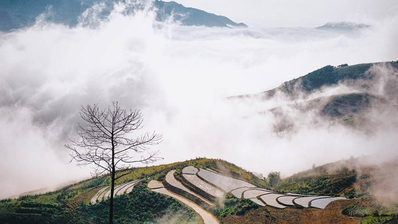
Standing on the top of Ta Xua, which is nearly 2,000 metres
above sea level, one can admire the spectacular views of mountains and
forests. If you are lucky enough to visit the peak on a day of favourable
weather, you can behold the layers of cloud sweeping down the sides of the
mountains, creating a picturesque and heavenly panorama.
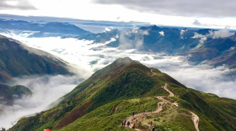
Another
adventurous challenge for travellers is to take on a breath-taking conquest
of "the spine of dinosaur” on the top of Ta Xua
Watching dawn break over the mountain is an unforgettable memory
for backpackers, who have to keep a close watch on weather conditions and be
present on the peak before 5 am.
There are countless photographers and travel lovers who spend
days staying at homestays in Ta Xua to capture dawn on the peak; however,
many of them have missed the moment despite their careful preparation and
research.
Another challenging option for travellers is to take on the
breath-taking conquest of "the spine of dinosaur” on the top of Ta Xua with a
rough path halfway up the mountain, extremely high cliffs and strong winds
along the two sides of the mountain.
Admiring picturesque rice terraces
In addition to Ta Xua commune, Hang Chu, Lang Chieu, and Xim
Vang communes are also attractive tourist sites. As a usual practice in April
and May of every year, the local people fully water their fields to prepare
for a new crop, making the surface of the green rice paddy terraces shine
like a mirror under sunbeams.
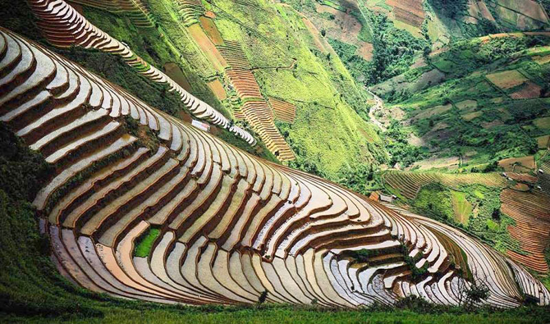
Mu Cang Chai district in Yen Bai province is renowned as the
land of the most picturesque multi-layer terraced rice fields in Vietnam. In
H’mong ethnic language, Mu Cang Chai means "village of dried
trees".
Rice terraces are a symbol of the wonderful farming initiative
throughout sloping mountains areas which are short of water resources, and
are examples of the perfect handiwork of the local people.
In April
and May every year, the locals fully water their fields to prepare for a new
crop, making the surface of green rice paddy terrace fields shine like a
mirror under sunbeams.
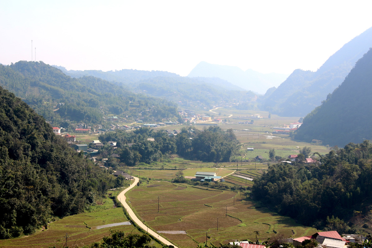
A number of homestays and community-based tourist products have
been built at the foot of Khau Pha mountain pass in the district, allowing
travellers to explore the indigenous culture and scenery.
Mu Cang Chai district People’s Committee recently announced a
plan to promote the locality’s well-known terraced rice fields with various
activities, including a rice transplanting and ploughing contest, performances
of folk songs and 'khen' (traditional bamboo pipe flute) of H’mong people.
Community-based tours are also designed to let tourists enjoy
the traditional cultural practices of Thai and H’mong ethnic people right
among the rice terraces.
Notably, a paragliding festival will be held for the second time
by the Vietwings Hanoi Paragliding Club from May 18 to 20, offering an
opportunity to paraglide over the area to enjoy panoramic views of Mu Cang
Chai’s scenic landscapes.
Last year’s event took place in mid-May, with the participation
of 100 pilots and a large number of visitors.
|
Source: NDO

Powered by ICT GROUP.